Tuesday, January 31, 2012

DERWENT BRIDGE

SUNDAY 29.1.2012: Continued on our way west with a stop at "The Wall". Artist Greg Duncan is creating a stunning sculpture at Derwent Bridge in the heart of Tasmania. The Wall in the Wilderness is Greg Duncan’s commemoration of those who helped shape the past and present of Tasmania’s central highlands. A work in progress, The Wall is being carved from three-metre high wooden panels. The carved panels will tell the history of the harsh Central Highlands region - beginning with the indigenous people, then to the pioneering timber harvesters, pastoralists, miners and Hydro workers. When completed The Wall will be 100 metres long. Greg Duncan’s sculpture The Wall will rank as a major work of art and tourist attraction in Tasmania. 


On Bob's recommendation (the Hamilton Policeman), we headed for the Derwent Bridge Hotel. Enjoyed a meal and along with other travellers spent the evening in the carpark. Derwent Bridge is a locality on the Lyell Highway at the southern edge of the Cradle Mountain - Lake St Clair National Park.

BRADYS LAKE

SATURDAY 28.1.2012: This time we really did find "T-H-E SPOT"! Bradys Lake Freedom Camp - parked beside the lake, no-one else in sight, beautiful! Both Madison and Shayden were able to run off lead, although they had to retreat indoors due to those annoying horse flys and the stones which played havoc with those ever so delicate paws!

Sunday, January 29, 2012

OUSE - POPULATION: 137

MEADOWBANK LAKE

FRIDAY 27.1.12: Went to New Norfolk where the town's pioneers were many of the 554 folk resettled from Norfolk Island during the period of 1807 to 1808. Originally called "The Hills" district, visiting New South Wales Governor Lachlan Macquarie named it Elizabeth Town after his wife, but in 1825 it was officially named New Norfolk by its residents. Stayed the night at Bethune Park, Ouse which is alongside the Meadowbank Lake. As always with this trip - the unexpected. Looking out the window and along comes a huge flock of sheep being mustered down the road. The cattle dogs came in and tried to 'round up' our motorhome, whilst Madison from the security of her home, - retaliated!

HAMILTON - POPULATION: 300

TUESDAY 24 - THURSDAY 26.1.2012: As we do, we searched for a location that we felt few people would want to spend Australia Day - found it! Hamilton - Governor Macquarie named the locality as 'Sorell Plains', and it became locally known as 'Macquarie' and 'Lower Clyde'. Governor Arthur finalised a name for the locality in 1824. Hamilton was once a bustling frontier town that contained many inns and several working breweries. It was once destined to be the capital of Tasmania despite its vast distance from any port. We took up residence on the Hamilton Common and prepared for Australia Day - yet again we seemed to be the only soldiers getting "into the spirit"! Visited the shops that were opened and supported the local potter.
GLEN CLYDE HOUSE
CIRCA 1846


The Old School House was designed to house 80 pupils. The building had classrooms for girls on one side and boys on the other, teacher and family lived upstairs. In 1935 a new weatherboard school was built next door.
THE OLD SCHOOL HOUSE
CIRCA 1858

1935
Emma's cottage is part of a collection built between 1830 and 1845. Emma's is the oldest and has internal timber split-slab walls fastened with wooden pegs.


JACKSON'S EMPORIUM
1856

Saturday, January 28, 2012

KEMPTON - POPULATION: 358

MONDAY 23.1.2012: We set off on our journey to the west coast of Tasmania. First stop The "Blue Place" - a Freedom Camp at Kempton. The Presbyterian Church (The "Blue Place"), was built in 1886. The Church was used by the local congregation for many years until it fell into disrepair after WWII. It was renovated and is now used as a community hall.
Originally the home of the Big River tribe of Aboriginal people, Kempton was first settled by Europeans in the 1820s, when it was known as Green Ponds. In 1838 the town was renamed after early administrator and businessman Anthony Fenn Kemp who established the property Mount Vernon immediately to the north of where the township later grew. 

W.H. ELLIS' GREEN
PONDS STORE 1843


Monday, January 23, 2012

HOBART

FRIDAY 20 - SUNDAY 22.1.2012: Back to our second home at the Hobart Showground. Completed the chores, charged up all the batteries and headed for down town Hobart! We boarded the Lady Nelson tall ship for a 90 minute sail round the harbour. In preparation for the turbulent seas Sybil downed the TravelCalm, whilst Carole braved the trip unaided. The winds never came - tall ships do not travel far without wind assistance! The Lady Nelson is a full size replica of the original "Lady Nelson" which sailed from England to Australia in 1800 and was involved in the first three European settlements in Tasmania and helped transfer the Norfolk Island settlers to Tasmania. In 1825 the first "Lady Nelson" was seized by natives at Babar Island in the Indonesian archipelago, the crew murdered and the ship burnt. Two small Carronades (cannons) are the only known remnants of the original vessel. About 1980 it was decided to build a Tasmanian tall ship. This vessel was built by Ray Kemp at Woodbridge in 1987 for the Tasmanian Sail Training Association which operates the vessel for the people of Tasmania.
      WAITING FOR THE BIG WIND!


Sunday, January 22, 2012

FRANKLIN - POPULATION: 453

WEDNESDAY 18 - THURSDAY 19.1.2012: Named after Sir John Franklin and his wife Lady Jane Franklin who subdivided a large property (formerly owned by John Price), to settle families of modest means. The Franklins had a ketch named Huon Pine built at Port Davey to provide a direct link between the settlement at Hobart. Having spent two days posing as athletically gifted bushwalkers by the time the Leyland Sisters arrived at the Franklin Foreshore Reserve they had hit the wall! We quickly slotted into our recovery program of dinner out followed by a movie at the Palais. 'Mission Impossible' so-so, but loved the old theatre! No queueing for tickets.

SOUTHERN FORESTS - TAHUNE

TUESDAY 17.1.2012: Having conquered the AirWalk we set out to traverse the Swinging Bridges and McKay's Track. Originally developed in the 1830's, McKay's Track is set along the Huon and Picton Rivers edge and you cross the rivers via two suspended swinging bridges. The walk was sign posted as an hour round trip
- we took two!
THE FIRST OF M-A-N-Y
BREAKS!


SWINGING BRIDGE


ECHIDNA SAID HELLO!

SOUTHERN FORESTS - TAHUNE

LOOK-IN LOOKOUT
MONDAY 16.1.2012: The next port of call was to the Southern Forests, home of the magnificent Huon Pine. En route we stopped at the "Look-In Lookout". The forests have a rich tradition of timber getting dating back to the 1850's. Commercial species include Blackwood, Celery-top pine, Leatherwood (honey production) and Tasmanian Oak. In addition the Southern Forests support a range of tourism, recreational activities, bee keeping and flora and fauna conservation. Beyond Tahune is the Warra Long Term Ecological Research site, part of a worldwide forest monitoring and research network. We headed out with a guided group to the Tahune AirWalk - a 50 minute return (0.6km) walk. The AirWalk is perched high in the forest canopy with spectacular views of the Huon and Picton Rivers.
TAHUNE AIRWALK FROM
THE GROUND


HUON RIVER


The last section of the AirWalk is freestanding over the water - the number of people on the walk at any one time is restricted.
HUON AND PICTON RIVERS


As we were finally in the State Forest and they permitted camping we thought we would take advantage.  The great outdoors, conquering the call of the wild and surviving on your natural instincts - albeit that we were parked in the 'overflow carpark'!

Saturday, January 21, 2012

SOUTHPORT

LUNE RIVER STATION
SUNDAY 15.1.2012: Off to the Ida Bay Railway and a 14klm return trip from the Lune River Station through lush bushland, with superb scenic water views of Ida Bay and Lune River Estuary. The Ida Bay Railway was originally built to transport limestone from Ida Bay quarries to waiting ships in the Lune River Estuary and Deep Hole Bay.  Near Southport Bluff is the King George III monument which commemorates the 134 lives lost in the sinking of the convict ship, King George III in 1835. Two 1940's war time Malcolm Moore Locos in operation were bought for the line in 1948. Built in the 1890's several of the passenger carriages are some of the earliest bogie wagons in Australia. We made several stops on our "trip" - time enough to soak up the history and take in the views.
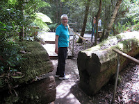
OUR DRIVER

JAGER FAMILY - ONE OF
THE TWO FAMILIES
IN THE AREA 

  
IDA BAY
    
TERMINATED AT DEEP HOLE

ELLIOTT'S BEACH