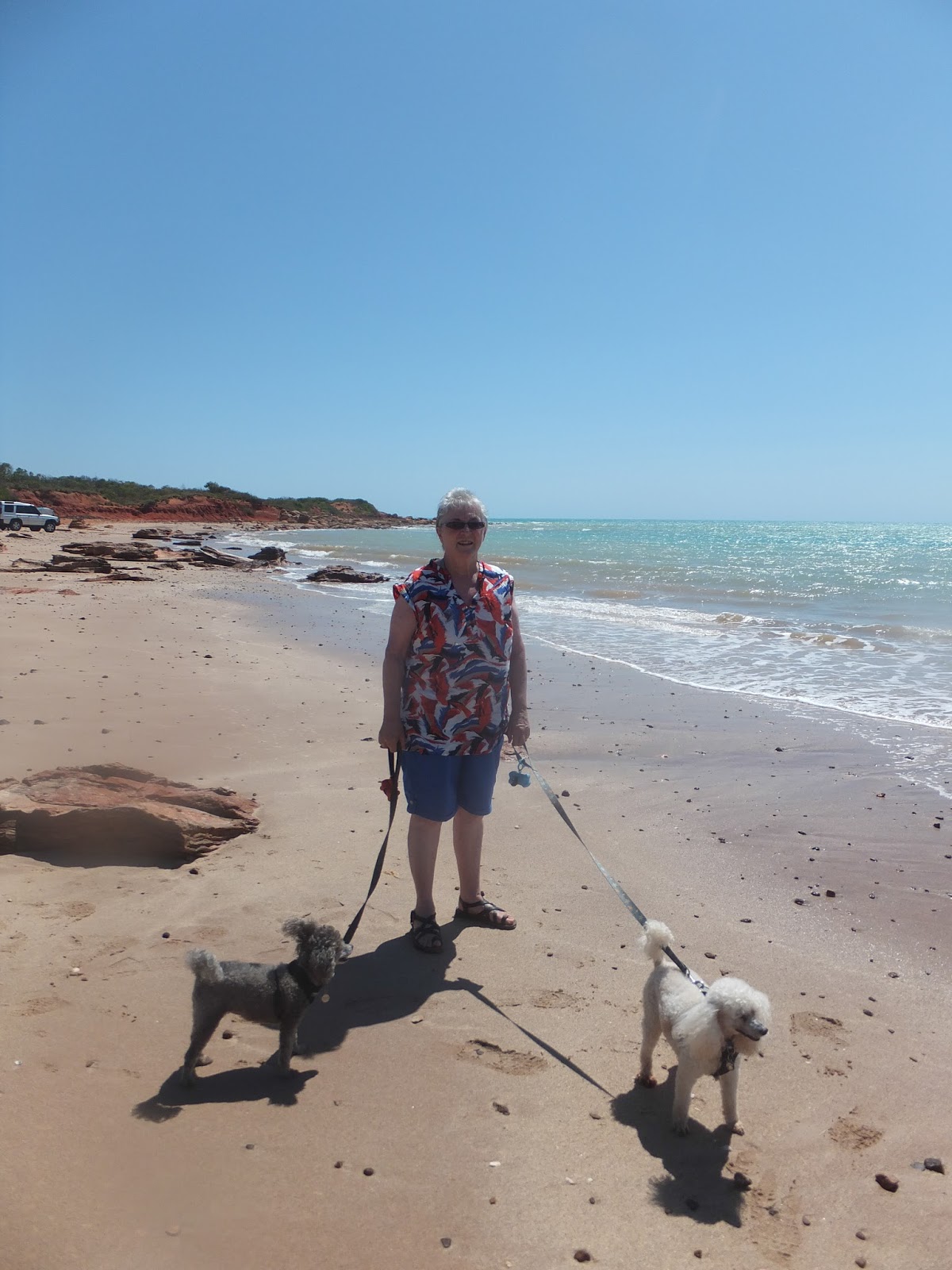
Thursday, September 26, 2013

ROEBOURNE

CLEAVERVILLE BEACH
YES, A BEACH FOR SHAYDEN'S GAME!
SHAYDEN ALSO HAD A TOUCH OF
MADISON'S PROBLEM, BUT HE IS OKAY NOW
TUES 17 - THUR 19.9.2013: We decided to stay at Cleaverville Beach ($45.00 for 8 nights), located 26 kilometres north-west of Karratha. It is popular for extended and overnight camping or day trips and has a number of secluded scenic sites. Access to Cleaverville Beach is via a 13 km maintained gravel road. It is amazing how long 13 kms feels when your top speed is 20kph! Absolutely love this stay, bar one problem - the sandflies and mosquitoes. Normally when you speak to people and they continually scratch you tend to take a step backwards, but here at Cleaverville it is an accepted idiosyncrasy - somewhat akin to a local cultural practice! We have used every type of insect repellent and the latest providing relief is a roll on deodorant (no particular brand), for easing the itch and a mixture of Dettol, Eucalyptus and Sorbeline for bite prevention - not sure if the intent is to inebriate or anaesthetise the insects!
NOT A BAD VIEW!


'BUNGARRA' - THERE ARE
5 DIFFERENT GOANNA
SPECIES
 
CLEAVERVILLE CAMP AREA

Wednesday, September 25, 2013

ROEBOURNE - POPULATION: 857

MONDAY 16.09.2013:  Roebourne was once the largest settlement between Darwin and Perth. Roebourne's name honours John Septimus Roe, the first Surveyor General of Western Australia. The Pilbara region was first explored by Francis Thomas Gregory in 1861. Gregory regarded the area as highly suitable for pastoral settlement. The first settlers, including Gregory's cousin Emma Withnell and her young family, arrived in the Roebourne area in 1863.
By 1865, the population of the area had grown to about 200, and the Withnells' property served as a local hub, with John Withnell opening a store and providing cartage services to the other settlers. The Government Resident, Robert John Sholl (1819–86), arrived in November 1865 to provide assistance in developing the region and set up camp near the Withnells' home while trying to find a suitable townsite. He eventually decided to locate the town at his camp, and on 17 August 1866, Roebourne became the first gazetted town in the North West. In 1872, the town was destroyed by a cyclone. Many of the buildings from shortly after this time are heritage listed. Gold from Nullagine, discovered in 1878, and surrounding copper and tin mines contributed to Roebourne's prosperity in the 1880s and 1890s. With the decline of both, Roebourne lost the majority of its European population and became a shadow of its former self. Remnants from that era of prosperity are various National Trust buildings around the town. The area was struck by another cyclone in 1925 that destroyed the Port Samson jetty. Several buildings were also destroyed with the towns residents seeking refuge in public brick buildings during the storm.
ORIGINAL BUILDING
Until the 1960s, Roebourne was a non-indigenous town operating as a regional administrative centre, with strict controls and curfews placed on movement of Aboriginal people to, from and within the town. Most Aboriginals were confined to camps and reserves a few kilometres away. However, as mining companies seeking to exploit the iron ore in the region constructed other company towns such as Dampier and Wickham for their workers, and as pastoralism declined, and with changing attitudes to Aboriginal welfare at the government level in the late 1960s, Roebourne became a majority Aboriginal town as people moved out of the crowded camps and reserves, and from the outlying stations. In later years, Roebourne became notorious for the struggles between Aboriginals and police that were documented in a federal report dealing with Aboriginal deaths in custody, which were documented as a major issue in Aboriginal affairs from the 1980s onwards. The report showed that Roebourne (with a largely Aboriginal population of 1,200) had ratios of police to citizens that were five times that of towns in more settled parts of Western Australia. The area is home to the Ngarluma people, but many Yindjibarndi and Banyjima people previously from outlying stations also live in the town.
The first stop was at the Roebourne Information Centre which is housed in the original gaol. This would have to be one of the most effective centres we have come across, from the obliging nature of the staff, to the facilities offered to the campers. On site they have three washing machines ($3.00 per load), plus you can partake of free coffee/tea whilst waiting, water (gold coin donation) and a book exchange, as well as booking your tours and obviously providing information. Situated in the Law and Order Precinct on Queen Street, Roebourne Old Gaol played a fascinating role in WA’s history and housed up to 40 prisoners at times, even though it was designed to accommodate only 14 prisoners.
ONE OF THE GAOL WINGS
The cell blocks of the Old Gaol were built in 1896, and it is most likely that a team of prisoners and local Indigenous people was utilised to gather and quarry the stone. It stands as a reminder of the harsh times that were endured throughout the colonial era.
REAR END OF THE GAOL

Monday, September 23, 2013

PORT HEDLAND - WEST PEAWAH RIVER

SALT DUNES ON THE WAY
INTO PORT HEDLAND
SUNDAY 15.09.2013: Onward to Port Hedland and after a scenic drive restocked our supplies. Port Hedland is the second largest town in the Pilbara region of Western Australia, with a population of approximately 14,000, including the satellite town of South Hedland, 18 km away. It is also the site of the highest tonnage port in Australia. Port Hedland has a natural deep anchorage harbour which, as well as being the main fuel and container reception point for the region, was seen as perfect for shipment of the iron ore being mined in the ranges located inland from the town. The ore is moved by railway lines from four major iron ore deposits to the east and south of Port Hedland area - very much a mining town. Had planned to stay at Port Hedland, but the only "dog friendly" accommodation was camping at the golf course for $25.00 per night.
AGAIN, WE PASSED INTERESTING
ROCK FORMATIONS
MINER'S TRIBUTE!
Just before reaching Port Hedland we passed a field of termite hills, with most of them sporting miner's hats.
It is amazing how many lone cyclists we have seen on the road since we began the trip - the distances are long enough when driven. Today we passed a lad walking to raise money for cancer research. Spent the night at the West Peawah River Rest Area of Port Hedland.

WEST PEAWAH RIVER
ONE WOULD SUGGEST THE TIDE IS OUT!

Sunday, September 22, 2013

STILL TRAVELLING!

SATURDAY 14.09.2013: Set up for the evening at De Grey River Rest Area 82 kms north east of Port Headland. Sitting back watching the world and two people with three dogs go by and we realised - it's Angela (Shayden's Fairy Godmother), and Simon from Tumbling Waters. "It's a small world after all....!"  
DE GREY RIVER
 

MORE & MORE TRAVEL DAYS!

THURSDAY 12 - FRIDAY 13.09.2013: Leaving the Kimberley and heading for the Pilbara - "where the desert meets the sea". First stop was at the Goldwire Rest Area, followed by the Sandfire Roadhouse some 291 kms north of Port Headland. Sitting outside Poodle Palace with dogs in tow and a view best described as a desert vista, when a virtual menagerie of animals made their way past our line of vision. As one would imagine, the poodles were quite vocal!
THE 'VISTA'
IT BEGAN WITH THE PEACOCK
AND FINISHED WITH WALLABIES
THAT WERE TOO QUICK TO PHOTOGRAPH!

BROOME'

WED 11.09.2013: A "must do" at Broome are the sunset camel rides on Cable Beach. There are three groups - we chose "Ships of the Desert" - 'Broome's original and best since 1981' (the yellow group). We set the poodles up in Cable Beach carpark and made our way down to the beach to the "yellow flag". We were introduced to our camels - Carole was on Zara (a group leader in the making), and Sybil on Ned (a 7 year old young'in).
The 'do's and don'ts were explained and we climbed aboard our rides with dignity and grace (haaaa)! Absolutely magical time, but very difficult to capture a straight horizon given the camel's gait. Finished the ride and in a somewhat bowlegged manner made our way up to the Sunset Bar and Grill where we had a lovely pizza and bottle of wine - perfect way to finish the day.


TRIVIA: Contrary to popular belief, a Dromedary camel does not store water in its hump. It is a mound of fatty tissue from which the animal draws energy when food is hard to find. Camels need very little water if their regular diet contains good, moisture-rich pasture.

Our time at Broome was very much tainted by the adverse reaction to the dogs. Broome is akin to Cairns with a very tropical tourist feel to it. For us it is a little large and spread, but having said that the area caters to all needs - except dogs!

Thursday, September 19, 2013

BROOME

MONDAY 9 - TUESDAY 10.09.2013: Our intention had been to stay at the PCYC - very basic accommodation with one unusual stipulation, you must own a dog. Unfortunately, the PCYC closed at the end of August so we went in search and found only one other option located in Broome proper. We have been told that Broome and many other places in WA were not pet friendly and the information has been correct. Made a booking at Tarangau Caravan Park and on arrival received a detailed list of pet rules, but nothing related to the park. Slithered into our nook and then realised for the first time we had a bus to town that stopped outside our door, but of course the dogs were not to be left home alone. You feel as though you are fortunate to be allowed entrance to the park given you have four legged ferals in tow! SO, decision was made to get out and about - "let's have a lovely barbecue lunch in a park".
BROOME PORT
We set off south to Broome Port, then east to Chinatown, north to Cable Beach and finally west to Gantheaume Point. Still no barbecue or park area. Finally set ourselves up for a scenic picnic next to the racecourse!
GANTHEAUME POINT

THE RACECOURSE!


Whilst in Broome we have had a change in dog breed. The new and improved models were sent off for a hair cut with a vet recommended cutter. We have never been ones for show cuts, BUT the puddles came back as afghans - no top knots! Not a good cut and costly. We have temporarily covered all the mirrors.
THE "FLATHEADS"
 

BROOME - POPULATION: 14,436

SUNDAY 8.09.2013: B-E-L-I-E-V-E IT OR NOT - This is a one off that HAS to be recorded. As we were leaving the Derby caravan park the Manager advised us that should we ever need a reference to support how well behaved our dogs were she would be only too happy to oblige - well who would have ever "thunk" it or for that matter believed it!
Feeling rather 'chuffed' we set sail to Broome. It is seldom boring when driving and today was no exception. Out from the bush runs a very well tanned man featuring a pink "Priscilla Queen of the Desert" pair of underpants. With arms waving he sprinted to the side of the road. Given the circumstances we were not prepared to stop, but some 50 metres up the road we hailed down a passing work truck. On a very desolate highway we pulled up side by side (as you do), and explained what had occurred and could they please ensure he was okay. The two men believed he was a hitchhiker, albeit rather atypical. Some days later we heard fellow tourists relating the tale of having to avoid the same man in the same outfit, standing in the middle of the road - nothin' like the outback!
We have been looking forward to visiting Broome as people have been 'black and white' in their opinions - "we loved it" or "we hated it"! It is often mistakenly thought that the first European to visit Broome was William Dampier in 1688, but he only visited the north of what was later named the Dampier Peninsula. In 1699 he explored the coast from Shark Bay to La Grange Bay, from where he headed north leaving the Australian coast. Many of the coastal features of the area were later named for him. In 1879, Charles Harper suggested that the pearling industry could be served by a port closer to the pearling grounds and that Roebuck Bay would be suitable. In 1883, John Forrest chose the site for the town, and it was named after Sir Frederick Broome, the Governor of Western Australia from 1883 to 1889.
CABLE BEACH
In 1889, a telegraph undersea cable was laid from Broome to Singapore, connecting to England. Hence the name Cable Beach given to the landfall site.
CABLE BEACH
 

JAPANESE CEMETERY


The town has an interesting history based around the exploits of the men and women who developed the pearling industry, starting with the harvesting of oysters for mother of pearl in the 1880s to the current major cultured pearl farming enterprises. The riches from the pearl beds did not come cheaply, and the town's Japanese cemetery is the resting place of 919 Japanese divers who lost their lives working in the industry.

DERBY

SATURDAY 7.09.2013: Our main reason for staying in Derby was to experience the Horizontal Waterfalls at the peak of the tides. With that in mind today had been carefully selected and we rose excited at the thought of the day's outing. We then view Madison shaking and panting in the corner - we went through our options and finally decided that as it was a shorter timeframe for the outing we would dose her up and if need be drive to Broome when we returned.
One of the most amazing natural features of the Kimberley region is the tidal waterfalls located deep within Talbot Bay in the Buccaneer Archipelago, but unlike any other waterfall, the water passes horizontally. Although they are called waterfalls, this natural phenomenon actually consists of intense tidal currents hurtling through two narrow coastal gorges. Massive tidal movements create a waterfall effect as water banks up against one side of the narrow cliff passage, to be repeated again on the turning tide. The twin gaps are part of the McLarty Ranges, which have two ridges running parallel approximately 300 metres apart. The first and most seaward gap is about 20 metres  wide and the second, most spectacular, gap is about 10 metres wide. It is possible to drive boats through the two gaps to the bay behind. The tides in this area have a 10 metre variation which occurs over six and a half hours from low tide to high tide and vice versa. The effect of the waterfalls is created by the tide building up in front of the gaps faster than it can flow through them and there can be a four metre high waterfall between the bays. The waterfall phenomena has been described by David Attenborough as "one of the greatest natural wonders of the world".
We were picked up from the caravan park and dropped at the airport where we boarded a seaplane (14 seat). We flew out to a pontoon situated near the Horizontal Falls. Had morning tea then we donned the life jackets and stepped aboard the "Jet Stream" (the fastest boat in the Kimberley) to "experience an exhilarating thrill ride through the Horizontal Waterfalls with our highly experienced skipper" - yes Sybil took TravelCalm! The ride was superb, but there were many kneecap and sky photos taken. 
Next a swim with the sharks, them on one side of the cage and humans on the other.
A "barra" lunch followed by a scenic boat ride and then a final burst on the "Jet Stream" to experience the waterfall at high tide. The morning ride was at low tide. 
LOW TIDE
LOW TIDE


HIGH TIDE

 
HIGH TIDE


WHERE THE SALT WATER
MEETS THE FRESH WATER


Madison was greatly improved by the time we arrived home so we will travel to Broome tomorrow as planned. In the interim we headed for the local school to cast our vote - later realised when Sybil kept maintaining that their were 1-9 options to be completed and that she knew none of the candidates, that she had been given the incorrect form to complete. Can imagine when the mail hits town and the counters try to make sense of the information!